File:Map of city center.png
Jump to navigation
Jump to search

Size of this preview: 724 × 600 pixels. Other resolution: 1,734 × 1,436 pixels.
Original file (1,734 × 1,436 pixels, file size: 1.47 MB, MIME type: image/png)
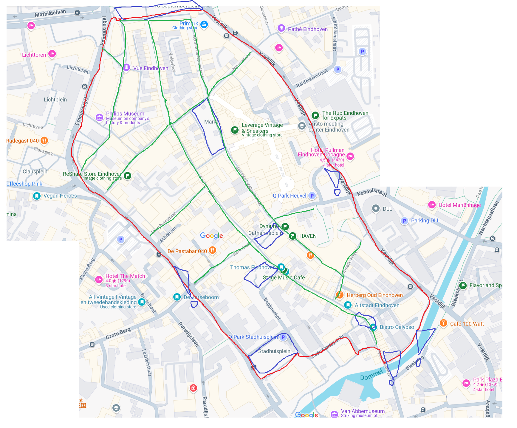
Map of city center. Outer bounds in red, Busy streets in green, squares in blue. Two exclamation marks in blue to highlight the relevant street crossings.
File history
Click on a date/time to view the file as it appeared at that time.
| Date/Time | Thumbnail | Dimensions | User | Comment | |
|---|---|---|---|---|---|
| current | 16:01, 17 March 2025 | | 1,734 × 1,436 (1.47 MB) | A.r.popal@student.tue.nl (talk | contribs) |
You cannot overwrite this file.
File usage
The following page uses this file: