File:Drone coastal.png
Jump to navigation
Jump to search

Size of this preview: 800 × 316 pixels. Other resolution: 878 × 347 pixels.
Original file (878 × 347 pixels, file size: 74 KB, MIME type: image/png)
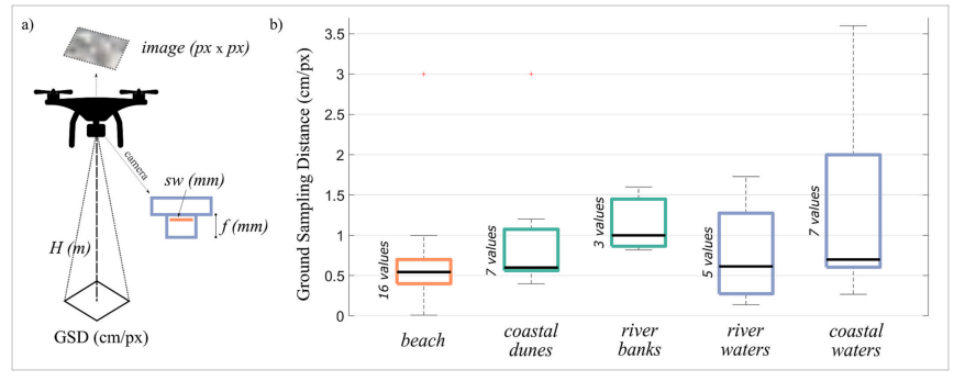
Fig. 1. Ground Sampling Distance of drone-based litter surveys. a) Schematic representation of Ground Sampling Distance (GSD) calculation. Following Eq. (1), the collected image is expressed in pixel square, sw indicates the sensor width, f the camera focal length, and H the drone flight height above the ground; b) GSD adopted by drone-based litter surveys found in the literature for different environmental domains and type of litter (blue backgrounds refer to floating litter)
File history
Click on a date/time to view the file as it appeared at that time.
| Date/Time | Thumbnail | Dimensions | User | Comment | |
|---|---|---|---|---|---|
| current | 13:08, 10 March 2025 | 878 × 347 (74 KB) | L.kirkels@student.tue.nl (talk | contribs) |
You cannot overwrite this file.
File usage
The following page uses this file: