Uploads by S148027
Jump to navigation
Jump to search
This special page shows all uploaded files.
| Date | Name | Thumbnail | Size | Description | Versions |
|---|---|---|---|---|---|
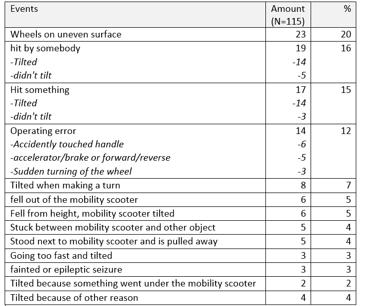
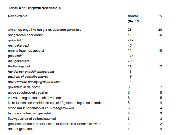
| 12:45, 1 April 2018 | Scnenario ongevallen en.png (file) |  |
41 KB | 1 | |
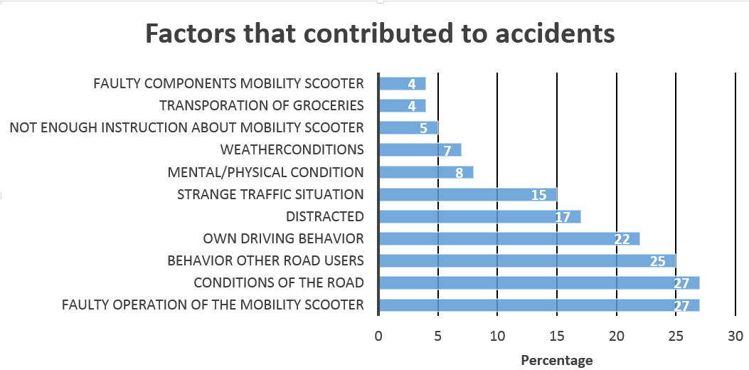
| 12:17, 1 April 2018 | Oorzaken ongevallen en.png (file) |  |
47 KB | 1 | |
| 23:03, 16 March 2018 | Sloped.jpg (file) |  |
220 KB | 1 | |
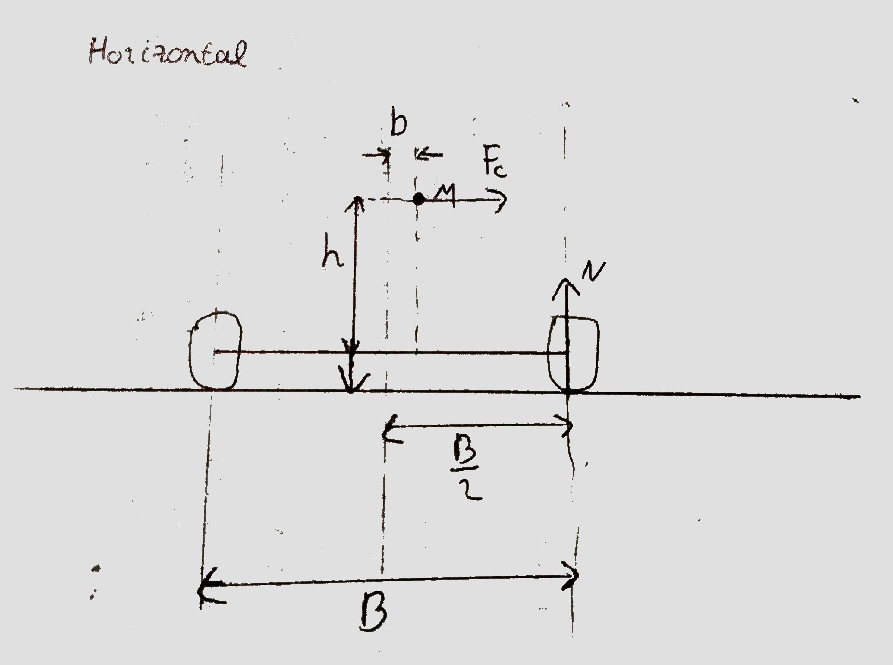
| 23:03, 16 March 2018 | Horizontal.jpg (file) |  |
159 KB | 1 | |
| 16:25, 24 February 2018 | Scnenario ongevallen.png (file) |  |
49 KB | 1 | |
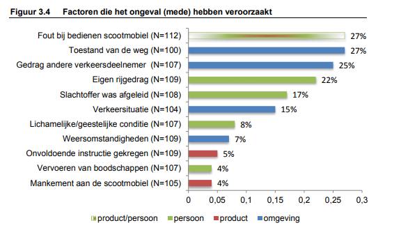
| 16:23, 24 February 2018 | Oorzaken ongevallen.png (file) |  |
57 KB | 1 | |
| 16:17, 24 February 2018 | Percentage of deaths mob.png (file) |  |
22 KB | Percentage of traffic related death of which the person was a mobility scooter driver in period of 2010-2016. | 1 |
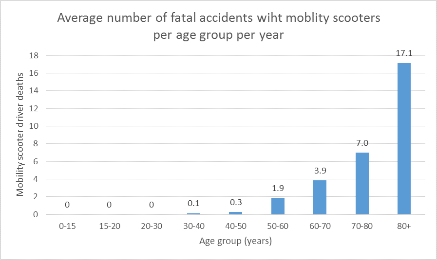
| 16:12, 24 February 2018 | Number of deaths.png (file) |  |
18 KB | Average number of death of mobility scooter drivers in period of 2010-2016 | 1 |
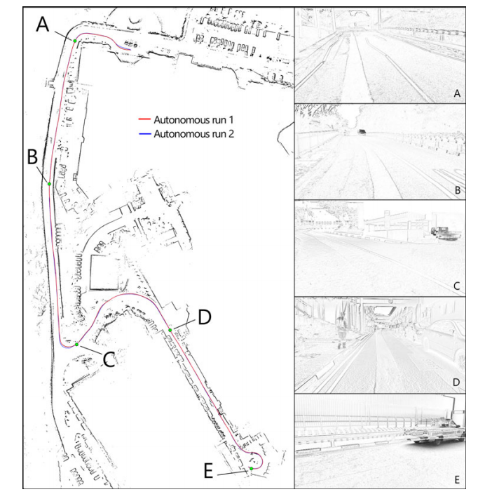
| 14:43, 18 February 2018 | Map example.png (file) |  |
371 KB | Example of visualization 2D mapping. Source: Z. J. Chong, B. Qin, T. Bandyopadhyay et al., “Synthetic 2D LIDAR for precise vehicle localization in 3D urban environment,” in IEEE International Conference on Robotics and Automation (ICRA), 2013, pp. 155 | 1 |
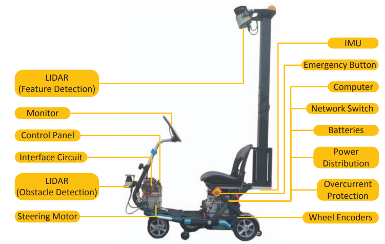
| 14:34, 18 February 2018 | Mobility scooter.png (file) |  |
174 KB | Example mobility scooter | 1 |